TrashVision™
Helping your city achieve compliance
TrashVision™ is an innovative, AI-driven solution that helps cities address the impact of trash on surface water quality and meet compliance for the 2030 state deadline which establishes an enforceable statewide goal to prevent trash greater than 5mm from reaching ocean waters, bays, or local waterways.
Policy
History
In 2015, the State Water Resources Control Board (SWRCB) adopted the Trash Amendments or Trash Provisions. This policy sets an enforceable statewide goal to prevent trash greater than 5mm from reaching ocean waters, bays, or local waterways by 2030.
Why do you need TrashVision™?
It’s Rapid & Repeatable
Fully understand the level of trash within your city in as little as two weeks
Streamlined Efficiency
TrashVision™ requires fewer man hours compared to OVTA
Accurate Results
TrashVision™ removes human subjectivity for a non-biased report
What TrashVision™ gives you…
Expert Oversight
You’ll get on-going expert oversight and experience from our TrashVision™ team
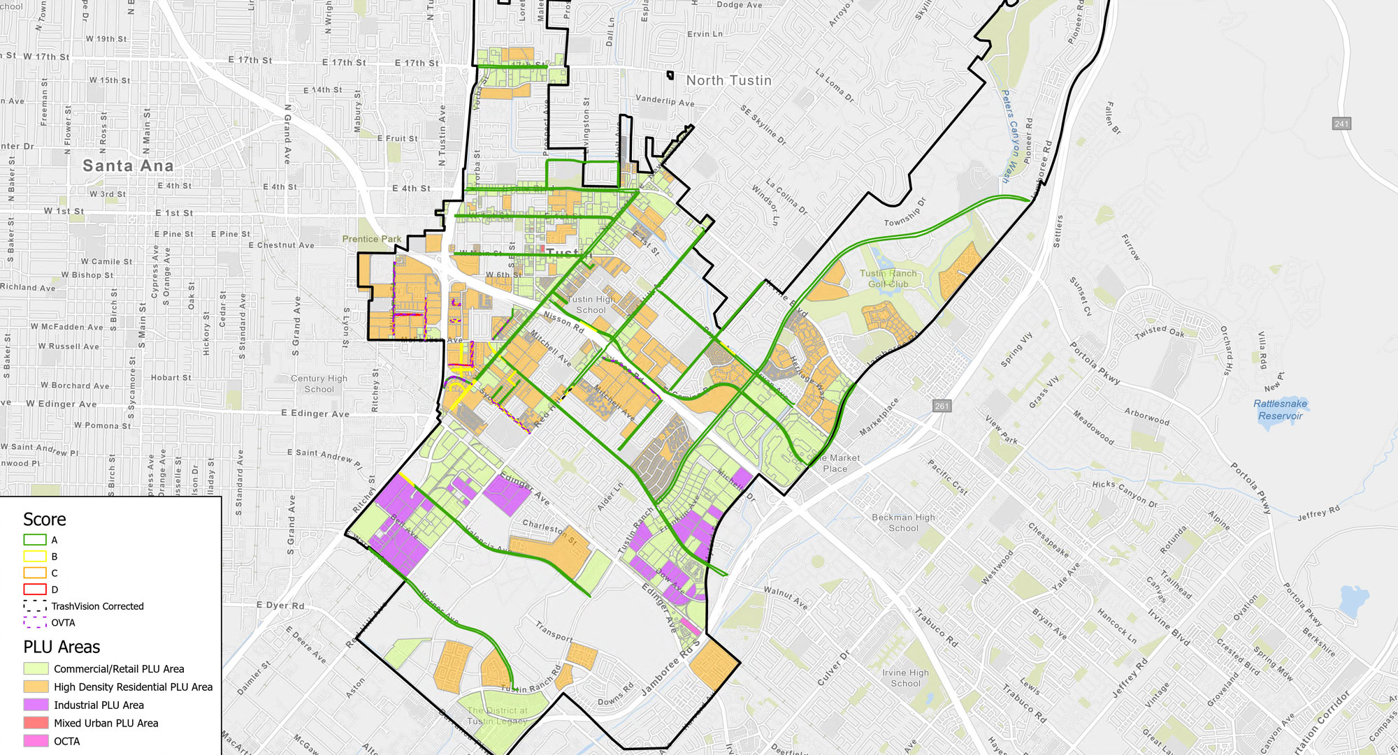
Graded Street Maps
You’ll receive a graded and color-coded map of driven street segments
Peace of Mind
You’ll have peace of mind knowing your city is in full compliance
“The recent proliferation of deep learning tools, datasets, and trash identification algorithms can help cities bridge the gap between sustainability frameworks and smart technologies leading to smart sustainable cities.”
Computers, Environment and Urban Systems, 2021
Meet Our Experts