Geospatial Technology

Precision, Innovation, and Real-World Application

From Vision
To Reality

A full spectrum of supporting services

We leverage advanced technology to provide cutting-edge geospatial services, enhancing survey, mapping, and land development projects. Our focus is on delivering high-quality data and models through optimized workflows and real-world coordinates.

Our Geospatial Technology Services

Supporting all phases of design

Get a birds-eye view

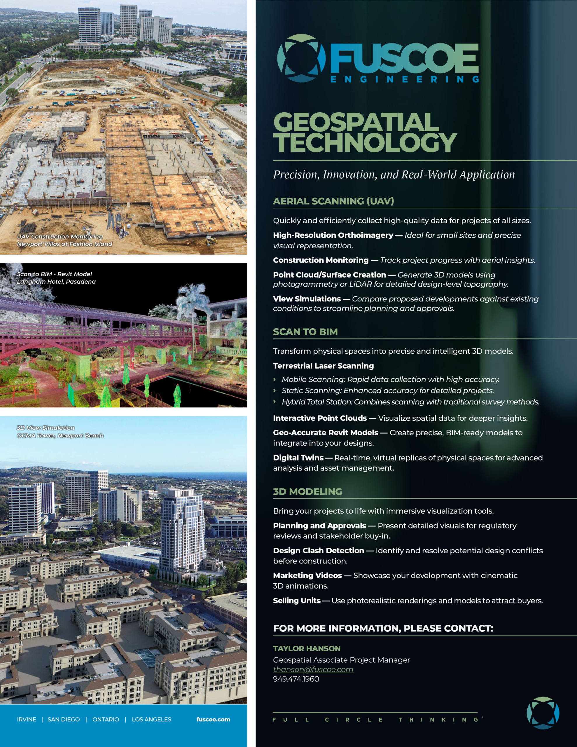
Aerial Scanning (UAV)

Harness the power of drone technology to quickly and efficiently collect high-quality data for projects of all sizes.

  • High-Resolution Orthoimagery: Ideal for small sites and precise visual representation.
  • Construction Monitoring: Track project progress with aerial insights.
  • Point Cloud/Surface Creation: Generate 3D models using photogrammetry or LiDAR for detailed design-level topography.

  • View Simulations: Compare proposed developments against existing conditions to streamline planning and approvals.

Capturing and using the data

Scan to BIM

Transform physical spaces into intelligent 3D models for planning and construction precision.

  • Terrestrial Laser Scanning:

  • Mobile Scanning: Rapid data collection with high accuracy.

  • Static Scanning: Enhanced accuracy for detailed projects.

  • Hybrid Total Station: Combines scanning with traditional survey methods.

  • Interactive Point Clouds: Visualize spatial data interactively for deeper insights.

  • Geo-Accurate Revit Models: Create precise BIM-ready models to integrate into your designs.
  • Digital Twins: Real-time, virtual replicas of physical spaces for advanced analysis and asset management

Brought to life…

3D Modeling

Bring your projects to life with immersive visualization tools tailored to various project needs.

  • Planning and Approvals: Present detailed visuals for regulatory reviews and stakeholder buy-in.

  • Design Clash Detection: Identify and resolve potential design conflicts before construction.

  • Marketing Videos: Showcase your development with cinematic 3D animations.

  • Selling Units: Use photorealistic renderings and models to attract buyers.

Harness the power of geospatial technology to see further, plan smarter, and build with confidence – because every great project starts with great data.
Meet Our Experts

Geospatial Technology Team

Kurt Troxell
Kurt TroxellPrincipal
Taylor Hanson
Taylor HansonGeospatial Associate Project Manager
Stephanie Ji
Stephanie JiData Analyst II
Fernando Jimeno
Fernando Jimeno3D Artist
From aerial scanning to digital twins, we transform real–world data into actionable insights with precision, innovation, and efficiency at every step.
Our Core Services

Check out our other core services